
![]()
![]()
I have just signed up as a volunteer on the Orchards East project – I will be researching the history of orchards in my local parish of Burnham-on-Crouch.
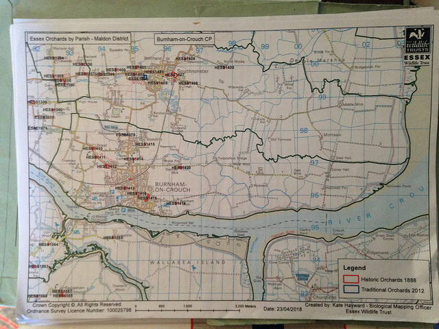
I’ve been provided with an OS map of the parish marked with the locations of orchards identified on the c.1888 ordnance survey map. My first task is to survey those sites for any extant orchards or what has replaced them. I’m beginning with the site nearest to my house, which has been designated HESS1416.
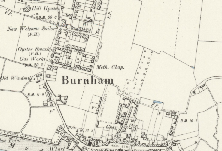
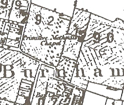
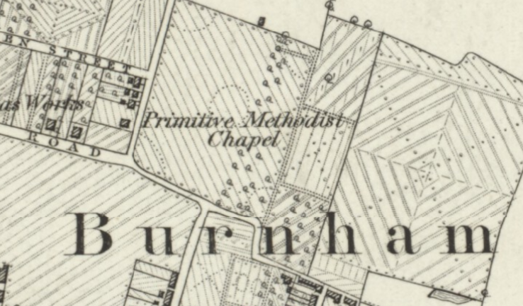
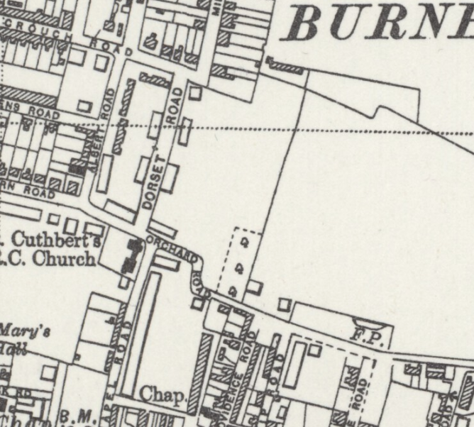
On the 1898 OS six-inch map this orchard stretches north easterly into agricultural (?) land, staggered in two rectangular blocks – the smaller of which had a point of road access on Tittyball Lane. According to the Burnham-on-Crouch Conservation Area Review and Character Appraisal, Tittyball Lane marked ‘the ancient line of division
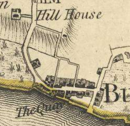
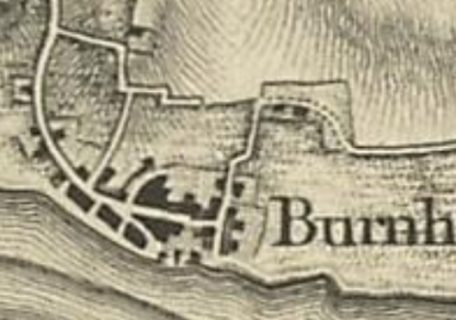
marking the rear boundary of the medieval settlement’ of Burnham – which is somewhat borne out by the 1777 Chapman/Andre map – little has changed by the first Ordnance Survey map of 1805 (neither indicate the presence of an orchard).
The first map giving an indication of an orchard is the tithe map of 1849, which appears to show a roughly square orchard plot in the crook of the dog-leg bend in Tittyball Lane within field 290, with perhaps another rectangular section of orchard adjacent to its west in field 292. Field 290 is listed as the property of Ephraim Murdoch, occupied by tenant William Newman, registered as pasture, and named Newman’s Meadow. Field 292 is listed as the property of John Wackrill, occupied by tenant James Blunden, registered as arable, and named Blunden’s Gardens. This western rectangular section is missing from most later maps, but does appear in finer detail in the 1880 OS six-inch map (surveyed 1873). In the 19th Century censuses James Blunden is listed as a seedsman or gardener. William Newman is listed as a farmer and gardener in White’s Directory for 1836 and mentioned as a farmer in mortgage documents at the Essex Record Office. Presumably both might be considered market gardeners, suggesting they produced a diverse range of product which could certainly have included fruit. [In That Time O’ Day: Memories Of Burnham On Crouch (1986), a local history book compiled by John Booth, a resident recalls that the area at the top of Ship Road and Providence was known as ‘Tittyball’ and was considered a poor area of town, and that ‘all down Albert Road there was cornfields. Wilfred Newman’s father had those, and he used to grow fields of mignonette, candytuft and nasturtiums. He grew them for seed.’]
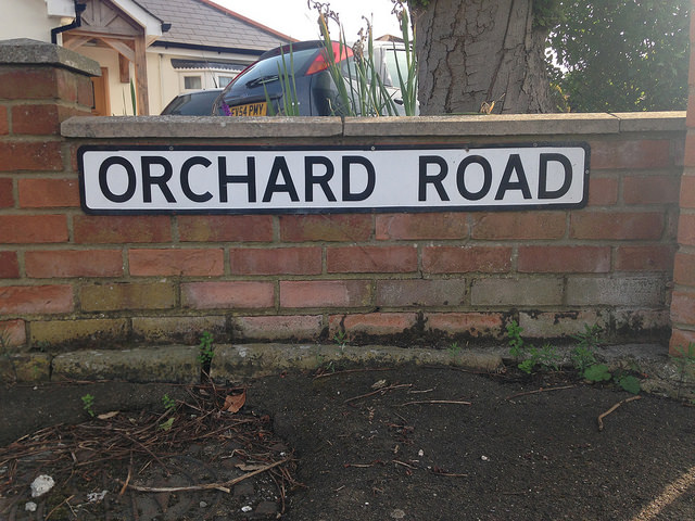
Sadly the street name Tittyball has not survived, but the lane certainly has, more recently renamed ‘Orchard Road’. It had gained it’s new name by 1920 as it appears as that on the OS six-inch map published in 1924 based on cartography which had been revised 4 years earlier and on the slightly more detailed OS 25 inch Essex (New Series 1913-) n LXXV.9 (Burnham) of 1921. The town has crept a little towards it, with buildings east of Albert Road, the extension of Crouch Road and the new Mildmay Road.
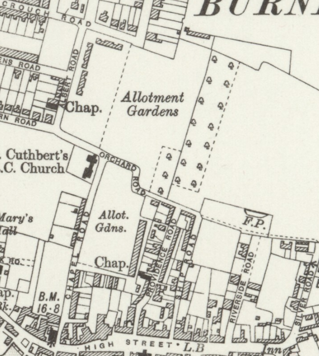
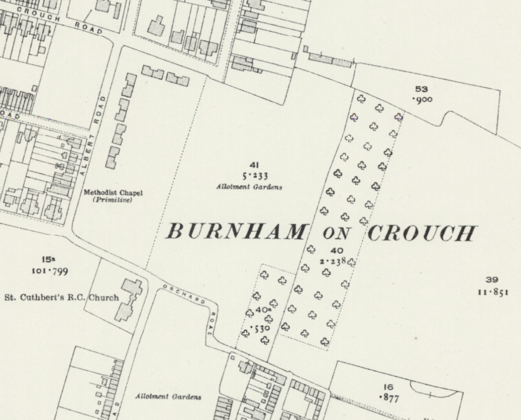
A further six-inch map revision in 1938 (published c.1945) shows only the smaller of the two rectangular blocks of orchard. The town has made another step forward, with Dorset Road now joining Crouch Road and Orchard Road, running parallel to Albert Road through what was allotment gardens. A new building sits next to the Orchard in what was once the corner to the larger, now absent block.
The 1945 ‘New Popular One-inch’ OS map Sheet 162 is much less detailed than those used previously, but it does show several of the orchards local to Burnham-on-Crouch. The area of Orchard Road shows no orchard however, just agricultural land (perhaps the trees were grubbed up for wartime arable cultivation?).

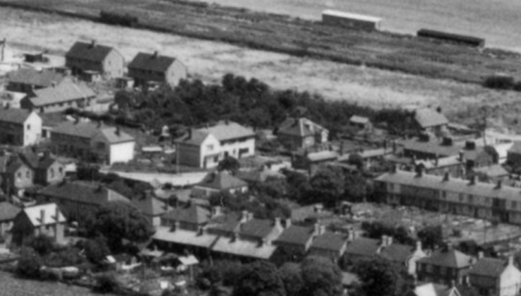
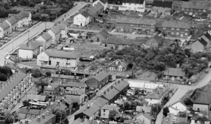
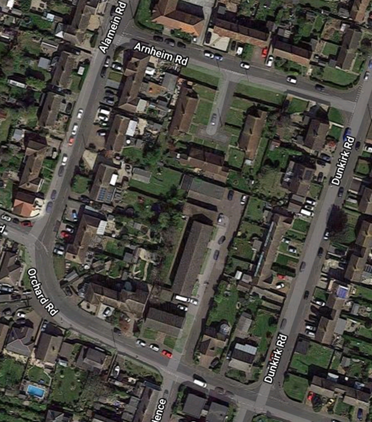
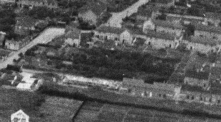
Aerial photographs from 1951 and 1953 indicate the many streets encroaching on the area, but there’s still an interesting clump of trees in the gardens of bungalows on the corner of Dunkirk Road – might they be an orchard remnant – there surely wasn’t enough time for any other trees to grow to that size since 1938?
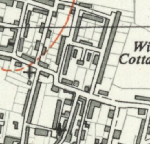
By the time of the smaller scale and more detailed 1:25,000 OS map Sheet TQ99, published in 1958, the campaign of new housing has subsumed the area. Dunkirk Road, Alamein Road and Normandy Avenue complete enclosing residential streets and the orchard seems to have been defeated completely – but the large gardens of the two houses on the corner of Orchard Road and Dunkirk Road still offer some space.
A look at the most recent Google Earth view shows some trees in the gardens, but no obviously recognisable orchard pattern and a walk around the streets looking over fences also provided no evidence of surviving fruit trees.
So an orchard appeared to have existed in some form on this site between at least 1844 and 1938, with one section adjacent to Orchard Road in continual use throughout the period – roughly a century of fruit production.
Addenda.
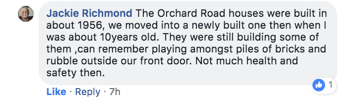
9th June 2018: I’ve been seeking assistance on a local facebook group Faces of Old Burnham-on-Crouch which has surfaced some information on the orchard’s last days.
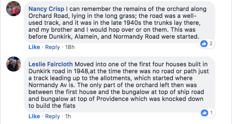
10th June 2018: Some more Facebook memories and another aerial photograph I found, this one also apparently from 1953 but showing a more extensive stand of trees. than the photos I included earlier.

[…] as was) and straight into the territory shown on the 1880 Six-inch OS map referred to in an earlier post. Perhaps his jolly-looking fruit-farmer and daughter were members of the Newman […]
LikeLike